Water Edge Garden Homestay
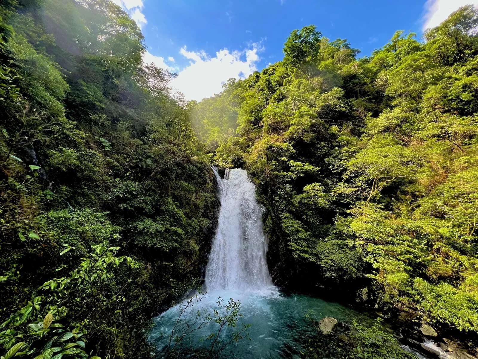
Official on-site Xinliao Waterfall Trail photograph:First-waterfall viewing platform
Back to all articles

Dongshan, Yilan forest trail · current status first

Xinliao Waterfall Trail guide|current status, first waterfall, transport and family hike

Check how far the route can currently be used before choosing a walk. This guide keeps the official 0.9, 1.2, 1.5 and 3.4 km records separate and puts the bee alert, storm risk and conditional second waterfall first.

Official on-site Xinliao Waterfall Trail photograph:First-waterfall viewing platform|林業及自然保育署宜蘭分署;WaterEdge AI 輔助衍生處理|林業及自然保育署政府網站資料開放宣告|AI-assisted derivative; not an unedited documentary photograph

Dongshan, Yilan forest trail · current status first

Check before departure

The official page currently shows a bee caution and no full-trail closure notice. Mountain access can still change for heavy rain, bee activity, rockfall or inspections; recheck the official status before departure.

新寮瀑布步道

The official trail page currently shows a bee caution rather than a full closure. That is not enough to promise the whole route is open, so check the official trail page again before leaving.

The current Yilan tourism page describes about 0.9 km one way to the first waterfall as the open section. The second waterfall remains a conditional extension that must be confirmed on the day.

The 0.9, 1.2, 1.5 and 3.4 km figures describe different dates, directions or route scopes. They should never be collapsed into one distance.

Effective alert · 2026-07-172026-09-17

Suspected bee nesting at the entrance

The official wording says only “bees”: keep your distance and pass promptly. Do not assign a specific species; leave if activity is obvious and follow staff directions.

Dongshan, Yilan forest trail · current status first

Quick facts

Address
宜蘭縣冬山鄉中山村新寮二路盡頭
Telephone
03-9580169
Managed by
Yilan Branch, Forestry and Nature Conservation Agency
Difficulty
Grade 1; steps and gradient increase beyond the first waterfall if that section is open
Elevation
About 103–205 m; elevation gain about 102 m
Route distance
About 0.9 km one way to the first waterfall; other figures need their date and definition
Suggested time
Allow 60–90 minutes for the conservative first-waterfall walk; not an official guarantee
Mountain permit
Not required; the route does not cross a protected or reserve area
Parking
An official car park is listed; fee and current rules are unconfirmed
Bus 281
Bus 281 from Luodong Transfer Station to Renshan Botanical Garden, then about 2.2 km on foot
Pets
Use a lead or carrier, bag or pet stroller; remove waste and prevent wildlife contact
Current alert
Suspected bee nesting at the entrance, valid 2026-07-17 to 2026-09-17

Dongshan, Yilan forest trail · current status first

Why official distances differ

Read every distance with its direction, date and destination

0.9km

one-way · current-tourism

Current Yilan tourism reference: about 0.9 km one way from the entrance to the first waterfall.

1.2km

official-total-unspecified · current-forestry

The Yilan forestry page says the trail is 1.2 km in total, without fully aligning that scope with the tourism page's one-way figure.

1.5km

one-way-full-route · historical-reopening

Historical 2018 reopening material described a 1.5 km one-way full route to the second waterfall; it is not a 2026 operating guarantee.

3.4km

round-trip · historical-original

The Forest Recreation travel guide records an older original route of 3.4 km round trip, as historical context.

Dongshan, Yilan forest trail · current status first

First and second waterfall routes

Current conservative reference60–90 min

Conservative first-waterfall route

about 0.9 km one way · First-waterfall viewing platform

Use the current Yilan tourism reference: about 0.9 km one way to the first-waterfall viewing platform. WaterEdge suggests 60–90 minutes for pauses, photos and visitor control.

  1. 1Trail entrance and control point
  2. 2Woodchip and gravel approach
  3. 3Stream-valley forest
  4. 4First-waterfall platform (current conservative reference)
Check before going90–120 min only when confirmed

Conditional second-waterfall extension

Check before going · Second waterfall

Official material notes steeper steps after 0.9 km, while 2018 historical sources mention bridges and elevated sections. Continue only when the current official status and entrance notice explicitly permit it; no fixed current distance is promised.

  1. 1Trail entrance and control point
  2. 2Woodchip and gravel approach
  3. 3Stream-valley forest
  4. 4First-waterfall platform (current conservative reference)
  5. 5Steeper steps (check before going)
  6. 6Second waterfall (conditional, not guaranteed open)

Dongshan, Yilan forest trail · current status first

Original route and elevation diagram

Read every distance with its direction, date and destination

  1. 1Trail entrance and control point
  2. 2Woodchip and gravel approach
  3. 3Stream-valley forest
  4. 4First-waterfall platform (current conservative reference)
  5. 5Steeper steps (check before going)
  6. 6Second waterfall (conditional, not guaranteed open)

Official on-site Xinliao Waterfall Trail photograph:Original route and elevation diagram|WaterEdge original route and elevation diagram

Dongshan, Yilan forest trail · current status first

Trail history

  1. 2006

    Trail opened

    Official history records completion and opening in 2006.

  2. 2009

    Typhoon damage

    Typhoon Parma damaged the trail and stream facilities in 2009.

  3. 2011

    First section restored

    The first-waterfall section was restored in 2011, returning a partial route.

  4. 2018

    Historical full reopening

    In 2018, official material described a 1.5 km full route to the second waterfall; this is historical context only.

  5. 2026

    Current check

    On 2026-08-01, the official page showed a bee caution, so this guide uses caution rather than open.

Dongshan, Yilan forest trail · current status first

Forest and stream ecology

Official on-site Xinliao Waterfall Trail photograph:Forest plants
Official on-site Xinliao Waterfall Trail photograph:Forest plants|林業及自然保育署宜蘭分署|林業及自然保育署政府網站資料開放宣告

Forest plants

Official records include Lauraceae, Fagaceae, large-leaved machilus, common red-stem fig, ferns, vines and epiphytes; sightings and identification are never guaranteed.

Official on-site Xinliao Waterfall Trail photograph:Stream birds
Official on-site Xinliao Waterfall Trail photograph:Stream birds|林業及自然保育署宜蘭分署|林業及自然保育署政府網站資料開放宣告

Stream birds

Official records include Taiwan whistling thrush, plumbeous water redstart, white wagtail, little forktail and maroon oriole; watch quietly from the path.

Official on-site Xinliao Waterfall Trail photograph:Forest plants
Official on-site Xinliao Waterfall Trail photograph:Forest plants|林業及自然保育署宜蘭分署|林業及自然保育署政府網站資料開放宣告

Forest mammals

Official records include squirrels, Formosan macaques, giant flying squirrels and wild boar; never approach, chase or feed them.

Official on-site Xinliao Waterfall Trail photograph:Insects and amphibians
Official on-site Xinliao Waterfall Trail photograph:Insects and amphibians|林業及自然保育署宜蘭分署|林業及自然保育署政府網站資料開放宣告

Insects and amphibians

Frogs, dragonflies, damselflies and swallowtails have been recorded; observe without catching or disturbing habitat.

Official on-site Xinliao Waterfall Trail photograph:Stream-valley forest
Official on-site Xinliao Waterfall Trail photograph:Stream-valley forest|林業及自然保育署宜蘭分署|林業及自然保育署政府網站資料開放宣告
Official on-site Xinliao Waterfall Trail photograph:Stream birds
Official on-site Xinliao Waterfall Trail photograph:Stream birds|林業及自然保育署宜蘭分署|林業及自然保育署政府網站資料開放宣告
Official on-site Xinliao Waterfall Trail photograph:Stream-valley forest
Official on-site Xinliao Waterfall Trail photograph:Stream-valley forest|林業及自然保育署宜蘭分署|林業及自然保育署政府網站資料開放宣告
Official on-site Xinliao Waterfall Trail photograph:Insects and amphibians
Official on-site Xinliao Waterfall Trail photograph:Insects and amphibians|林業及自然保育署宜蘭分署|林業及自然保育署政府網站資料開放宣告
Official on-site Xinliao Waterfall Trail photograph:Insects and amphibians
Official on-site Xinliao Waterfall Trail photograph:Insects and amphibians|林業及自然保育署宜蘭分署|林業及自然保育署政府網站資料開放宣告
Official on-site Xinliao Waterfall Trail photograph:Insects and amphibians
Official on-site Xinliao Waterfall Trail photograph:Insects and amphibians|林業及自然保育署宜蘭分署|林業及自然保育署政府網站資料開放宣告

Dongshan, Yilan forest trail · current status first

Bees, storms and post-rain safety

Bee safety

Keep away, pass promptly through the caution area and do not strike insects or approach a suspected nest.

Heavy rain and typhoons

Do not enter during precautionary closure, heavy rain, typhoon conditions or official inspection.

After rain

Cancel when water is turbid or faster, rockfall is possible or surfaces are slick; post-rain is not advertised as best.

Waterfall and current

Do not enter the plunge pool, swim, cross barriers or leave the trail.

Dongshan, Yilan forest trail · current status first

Transport and parking

Drive via local roads

From Provincial Highway 9 or Luodong's ring road, take Yicheng Road Section 3 toward Zhongshan Leisure Agricultural Area, then Xinliao Road to the trailhead.

Drive via Freeway 5

Leave at Luodong Interchange, then use Guangrong Road, Yicheng Road Section 3, Zhongshan Leisure Agricultural Area and Xinliao Road.

Bus 281 and walk

Take 281 from Luodong Transfer Station to Renshan Botanical Garden, then walk about 2.2 km; use the official live service rather than a fixed timetable here.

Check live bus 281 information

Stable map link

Both supplied short links were verified as the same place. The guide uses a transparent Google Maps search URL with the formal Dongshan address.

Navigate to the entrance in Google Maps

Car park listed

The official attraction page lists a car park; current entrance layout follows on-site signs.

Parking fee unknown

This guide does not call parking free or publish an unverified rate.

Dongshan, Yilan forest trail · current status first

Families, seniors, access and pets

Children and the first waterfall

The first section better suits children who can walk independently and follow stream-valley safety rules.

Seniors can turn back

Use the first waterfall as a reasonable turnaround and never treat the second as compulsory.

Strollers

Gravel, roots, natural surfaces and gradients require an on-site assessment.

Water access

This is not a lifeguarded recreation pool; obey all local signs before approaching water.

Wheelchairs

There is insufficient official evidence for a whole-route wheelchair claim.

Trail structures

Bridges, steps or elevated structures may be inspected or controlled; entrance notices take priority.

Pets on restraint

Use a lead or a carrier, bag or stroller and remove waste.

Protect wildlife

Keep pets from contacting, chasing or disturbing wild animals.

Dongshan, Yilan forest trail · current status first

Three visit plans

60–90 minCurrent conservative reference

60–90 minute first-waterfall walk

Use the current 0.9 km one-way tourism reference conservatively

  1. 1. Read the entrance and bee alert
  2. 2. Walk through the stream valley to the first platform
  3. 3. Return the same way with rest time
90–120 minCheck before going

90–120 minute conditional extension

Use only when official and entrance notices clearly confirm the second section

  1. 1. Complete the first-waterfall route
  2. 2. Recheck access beyond 0.9 km
  3. 3. Turn back immediately at closure or slippery conditions
half dayCurrent conservative reference

Dongshan forest half-day

Do not depend on reaching the second waterfall; add a verified nearby stop

  1. 1. Complete the conservative first-waterfall walk
  2. 2. Choose Renshan Botanical Garden or Zhongshan Leisure Agricultural Area from current official information
  3. 3. Keep time for transport, cleanup and weather changes

Dongshan, Yilan forest trail · current status first

Nearby trips and lodging

Dongshan, Yilan forest trail · current status first

FAQ

Is Xinliao Waterfall Trail currently open?

As of 2026-08-01, the official page showed a bee caution rather than a full closure. Without a dedicated community-trail reopening notice, this guide presents a caution and asks you to recheck.

How long does the entrance bee alert remain valid?

The official validity is 2026-07-17 through 2026-09-17. After that date, it must not remain active without a new check.

Does the official alert identify a species?

No. The official wording says suspected bee nesting and does not identify a species.

How far is the first waterfall?

The current Yilan tourism page describes about 0.9 km one way from the entrance to the first waterfall.

Can I currently reach the second waterfall?

Do not assume so. The second waterfall requires a fresh check and depends on current official and entrance notices.

Why are 0.9, 1.2, 1.5 and 3.4 km all published?

They cover different years, directions and route scopes. This guide preserves each record instead of manufacturing one number.

Is 1.2 km one way or round trip?

The Yilan forestry page says total 1.2 km, while other route text is internally inconsistent, so this guide does not infer one-way or round-trip.

How much time should I allow?

Allow 60–90 minutes for the conservative first-waterfall route. This editorial allowance includes photos, rest and controls, not an official guarantee.

Are there fixed opening hours?

The main official pages checked here do not clearly publish fixed daily hours. Visit in daylight and check the official page or call 03-9580169.

Is there an admission fee?

The checked official pages do not clearly publish a formal price, so this guide does not promise permanent free entry.

Is parking free?

Unknown. An official car park is listed, but its fee is not confirmed, so it is not described as free.

How do I use bus 281?

Ride 281 from Luodong Transfer Station to Renshan Botanical Garden, then walk about 2.2 km. Check the official live service rather than a timetable copied here.

Is 350 a daily limit?

No. The tourism page calls 350 the simultaneous capacity, not a daily quota.

Is the trail suitable for children or seniors?

The first section better suits children who walk independently; seniors can turn back at the first waterfall. Any open extension is steeper.

Can strollers and wheelchairs use the whole trail?

No whole-route claim is supported. Natural gravel, roots, gradients and wet surfaces require an on-site assessment.

Can I bring a pet?

Yes, with a lead or a carrier, bag or stroller, waste removal and no wildlife contact; current site controls still apply.

Can I swim or enter after rain?

No. Cancel in heavy rain or when water is turbid or fast. The stream and plunge pool are not presented as lifeguarded swimming water.

Is a mountain permit required?

No mountain-entry permit is required and the official data says the route does not cross a protected or reserve area; trail controls still apply.

Official sources

Image sources and licences

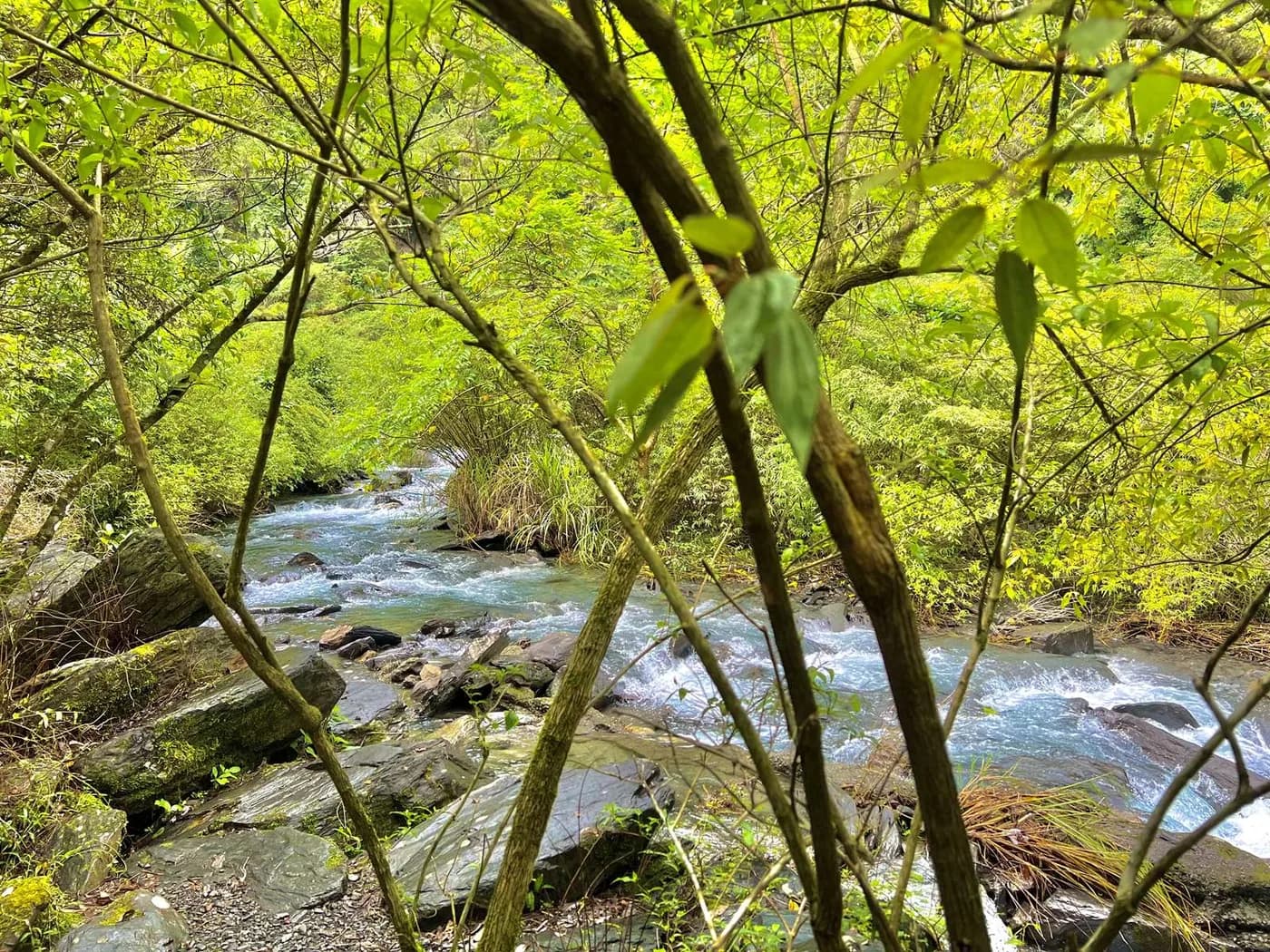
  • hero-first-waterfall · 林業及自然保育署宜蘭分署(頁面未另列攝影者) · 林業及自然保育署政府網站資料開放宣告 · AI-assisted wide recomposition from the licensed official real photograph · people and personal items removed if present · waterfall setting retained · 1600×900 WebP q82 · metadata stripped · not an unedited documentary image
  • forest-stream · 林業及自然保育署宜蘭分署(頁面未另列攝影者) · 林業及自然保育署政府網站資料開放宣告 · auto-orient · proportional resize where needed · WebP q82 · metadata stripped · no AI edit
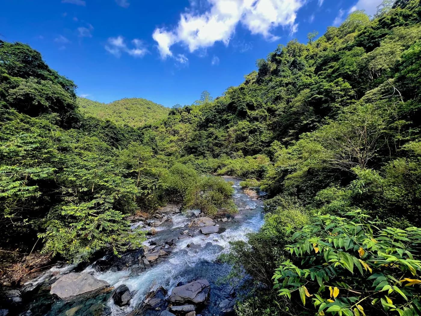
  • valley-stream · 林業及自然保育署宜蘭分署(頁面未另列攝影者) · 林業及自然保育署政府網站資料開放宣告 · auto-orient · proportional resize where needed · WebP q82 · metadata stripped · no AI edit
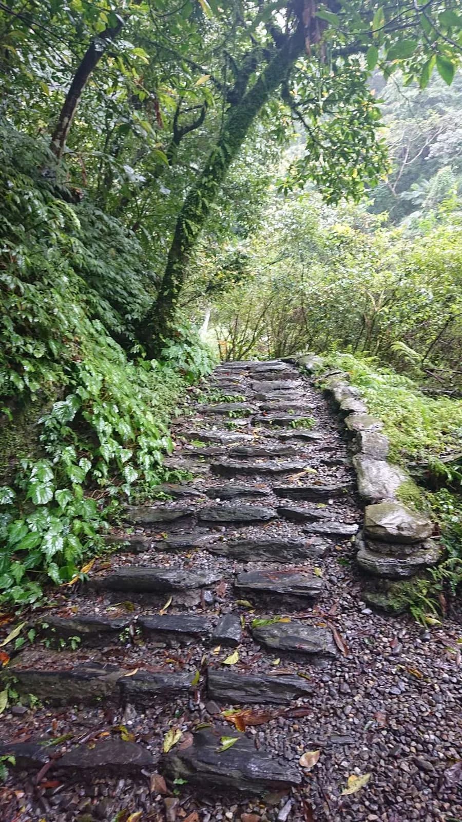
  • steep-stone-steps · 林業及自然保育署宜蘭分署(頁面未另列攝影者) · 林業及自然保育署政府網站資料開放宣告 · auto-orient · proportional resize where needed · WebP q82 · metadata stripped · no AI edit
  • rocky-creek · 林業及自然保育署宜蘭分署(頁面未另列攝影者) · 林業及自然保育署政府網站資料開放宣告 · auto-orient · proportional resize where needed · WebP q82 · metadata stripped · no AI edit
  • forest-flower · 林業及自然保育署宜蘭分署(頁面未另列攝影者) · 林業及自然保育署政府網站資料開放宣告 · auto-orient · proportional resize where needed · WebP q82 · metadata stripped · no AI edit
  • forest-fruit · 林業及自然保育署宜蘭分署(頁面未另列攝影者) · 林業及自然保育署政府網站資料開放宣告 · auto-orient · proportional resize where needed · WebP q82 · metadata stripped · no AI edit
  • damselfly · 林業及自然保育署宜蘭分署(頁面未另列攝影者) · 林業及自然保育署政府網站資料開放宣告 · auto-orient · proportional resize where needed · WebP q82 · metadata stripped · no AI edit
  • dragonfly · 林業及自然保育署宜蘭分署(頁面未另列攝影者) · 林業及自然保育署政府網站資料開放宣告 · auto-orient · proportional resize where needed · WebP q82 · metadata stripped · no AI edit
  • butterflies · 林業及自然保育署宜蘭分署(頁面未另列攝影者) · 林業及自然保育署政府網站資料開放宣告 · auto-orient · proportional resize where needed · WebP q82 · metadata stripped · no AI edit
  • xinliao-route-elevation · WaterEdge editorial · WaterEdge original editorial SVG · Original SVG · no map tiles · not traced from an official map · not to scale · conditional second-waterfall segment dashed

Checked on 2026-08-01 against the listed official sources. Trail access, bees, heavy rain, typhoons, structures, capacity, parking and the second-waterfall section can change; this is not a live access, safety, admission or parking guarantee.

Published July 5, 2026Last updated July 6, 2026

訂房詢問

0921-775-145 · 週一至週日 09:00 至 21:00

預訂請使用中文或英文聯繫。